SPOT: Site Planning and Observation Tool
About SPOT
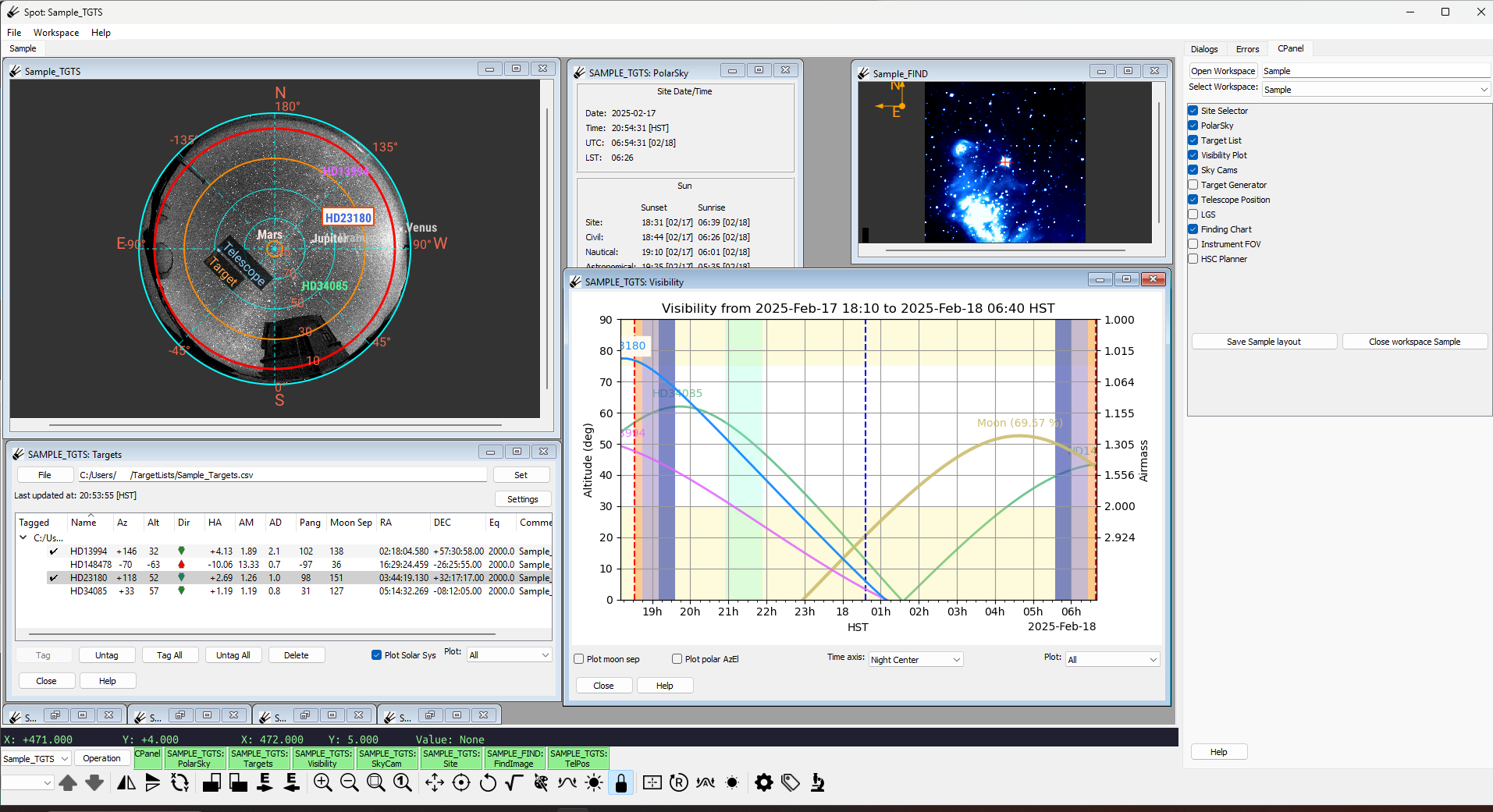
SPOT (Site Planning and Observation Tool) is a graphical tool for planning and conducting astronomical observations at a site. Spot centers around a sky window which can display targets from a file along with recent all sky (fisheye) images from the telescope site. It supports:
Zooming and panning
Color and intensity mapping
Plotting targets from csv and ope files
It also contains a display for showing catalog images, which can be setup to include instrument field of view overlays on top, and a target visiblity chart for tracking the elevation of targets over time.
Copyright and License
Copyright (c) 2023-2025 SPOT Maintainers. All rights reserved.
SPOT is distributed under an open-source BSD licence. Please see the
file LICENSE.md in the top-level directory for details.
Requirements and Supported Platforms
Because SPOT is written in pure Python, it can run on any platform that has the required Python modules.
Getting the Source
Clone from Github:
git clone https://github.com/naojsoft/spot.git
Documentation
Be sure to also check out the SPOT wiki.
Bug Reports
Please file an issue with the issue tracker on Github.
SPOT has a logging facility, and it would be most helpful if you can invoke SPOT with the logging options to capture any logged errors:
spot --loglevel=20 --log=spot.log --stderr